Ohio Key
Appearance
 Ohio Key with campsite under development. | |
| Geography | |
|---|---|
| Location | Gulf of Mexico |
| Coordinates | 24°40′19″N 81°14′49″W / 24.672°N 81.247°W |
| Archipelago | Florida Keys |
| Adjacent to | Florida Straits |
| Administration | |
| State | Florida |
| County | Monroe |
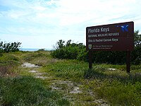
US 1 (or the Overseas Highway) crosses the Ohio Key at approximately mile marker 39, between Missouri Key and Bahia Honda Key. Today it is also known as Sunshine Key,[1] after a camping resort located there. The portion of the island south of U.S. Route 1 is protected as the Ohio Key National Wildlife Refuge.


Former name
[edit]It was once known as Little Duck Key, however the name Little Duck Key is currently used for a very small island about a mile (1.6 km) to the east that is the western terminus of the Seven Mile Bridge.
Flora and fauna
[edit]The oceanside area of Ohio Key has palm trees, buttonwood trees and mangrove trees, and bird watching occurs there.[2]
References
[edit]- ^ McCarthy, K.M. (1992). The Book Lover's Guide to Florida. Pineapple Press. p. 264. ISBN 978-1-56164-012-6. Retrieved September 7, 2017.
- ^ Gray, J. (2015). Insiders' Guide to Florida Keys & Key West. Insiders' Guide Series. Globe Pequot Press. p. 119. ISBN 978-1-4930-1554-2. Retrieved September 7, 2017.


